

|
This itinerary is a suggestion for 7 nights, walking 65 miles along one of the most diverse sections of the Brittany coast; undiscovered by most visitors to Brittany.
The south coast, including this section, enjoys the best climate in Brittany with over 2000 hours of sunshine a year. Your itinerary can include rest days and take longer than 7 days. You can do the walk in either direction. You can do a section of the walk (minimum of 3 nights) and you can walk further in a day, the itinerary can be done in 6 nights. Days that are too long can be shortened. |
1st night Campsite at Concarneau 2nd night Campsite at Trégunc (9 miles) 3rd night Campsite at Port Manec'h (11.3 miles) 4th night Campsite at Port de Bélon (13.3 miles) 5th night Campsite at Kerfany Plage (12.4 miles) 6th night Campsite at île Percée (9.1 miles) 7th night Campsite at Le Pouldu (9.6 miles) Total distance 65 miles Cost 1 person 980€ (7 nights) 2 people 1190€ Additional rest days 110€/140€ |

|
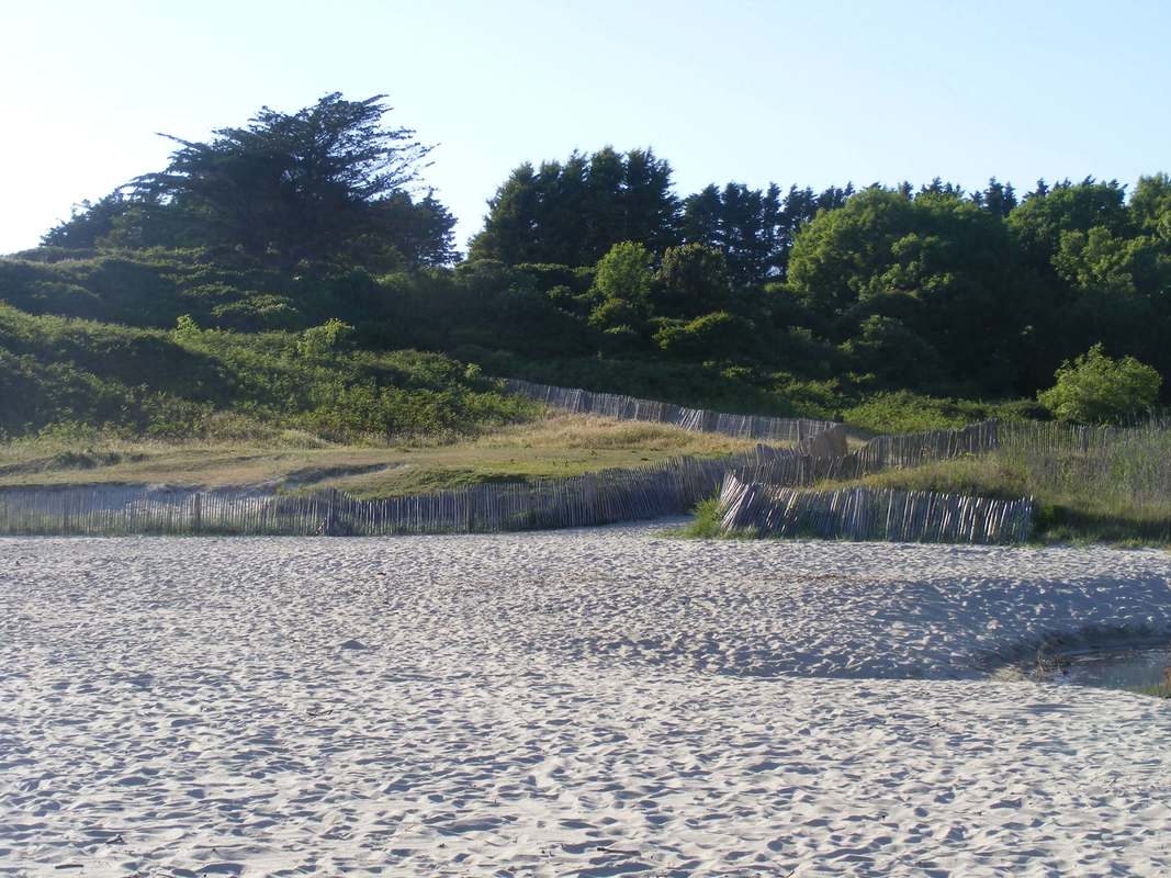
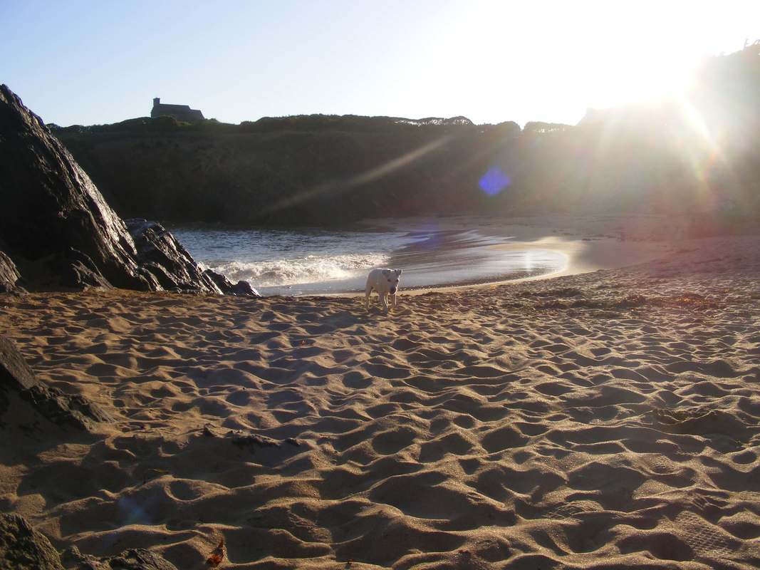
The first day's walking (9 miles) is level walking on a good path. A day of inlets, moorings, boulders and beaches. One of the best beaches being la Plage de Pendruc where you'll be camping for the second night.
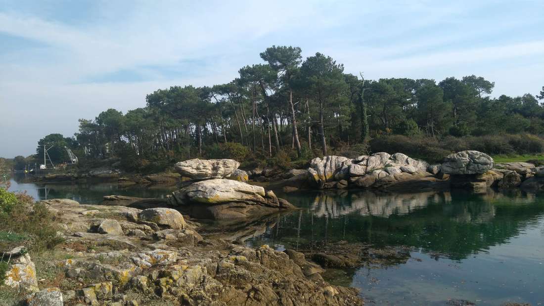
Massive granite boulders guard the entry to an inlet close to Concarneau

A traditional Breton craft
|
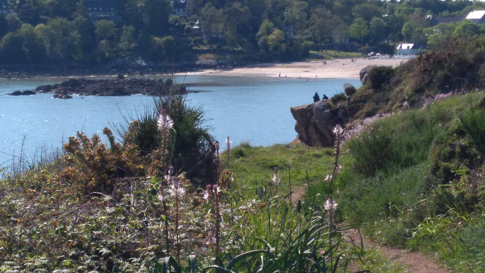
Plage de Pouldohan seen from the sentier côtier, not far from Concarneau
|
|
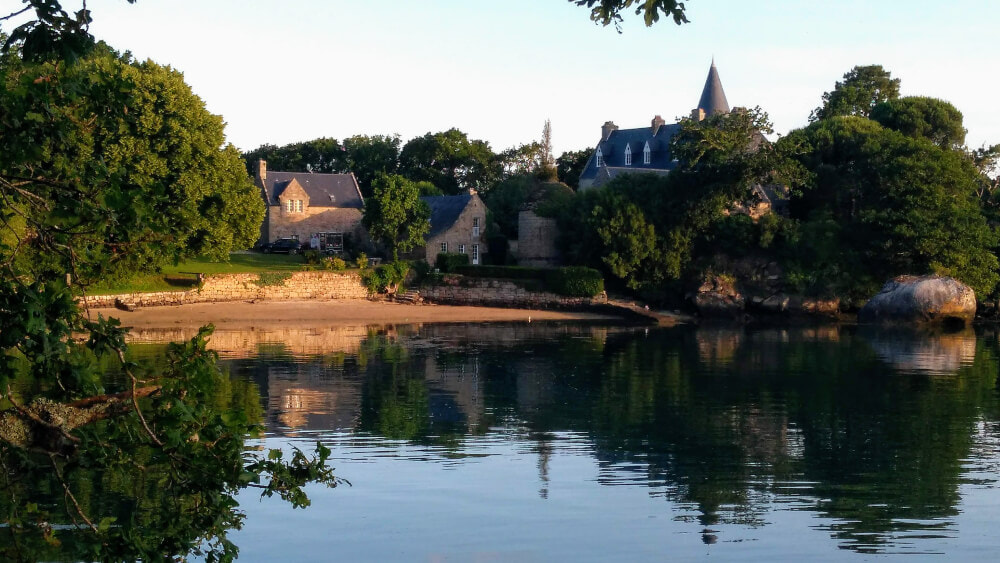
The second day's walk (11.3 miles) starts with a nature reserve. The beach on one side and lakes on the other. You are heading for Nevez; a commune blessed with beautiful beaches. Port Manec'h where spend your 3rd night has one of Nevez's most celebrated beaches.
Port Manec'h, Nevez.
|
La Plage de Tahiti and L'anse de Rospico are Nevez's best known beaches.
L'anse de Rospico, Nevez.
|
|
The third day's walk (13.3 miles) is the longest. It is, however, flat. Many chose to walk the first and best half as far as Pont Aven; have a leisurely lunch and be picked up and driven to the campsite at Port de Bélon, famous for its oysters. An oyster knife is provided as part of your camping equipment..
Chateau de Poulguin just out of Port Manec'h on the way to Pont Aven
|
Pont Aven is somewhat crowded and chaotic with Gauguin's spell still strong. There are, as a result, plenty of decent places for lunch.
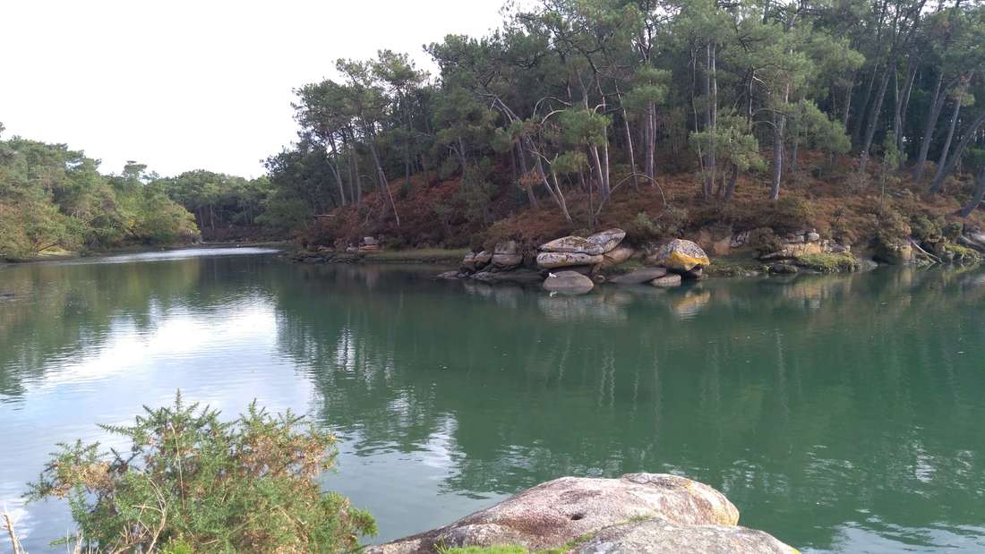
After the chocolate box chaos and mill streams of Pont Aven, the river reverts to wilderness. Best appreciated from the path on the right bank (looking downstream) which hugs the water's edge.
|
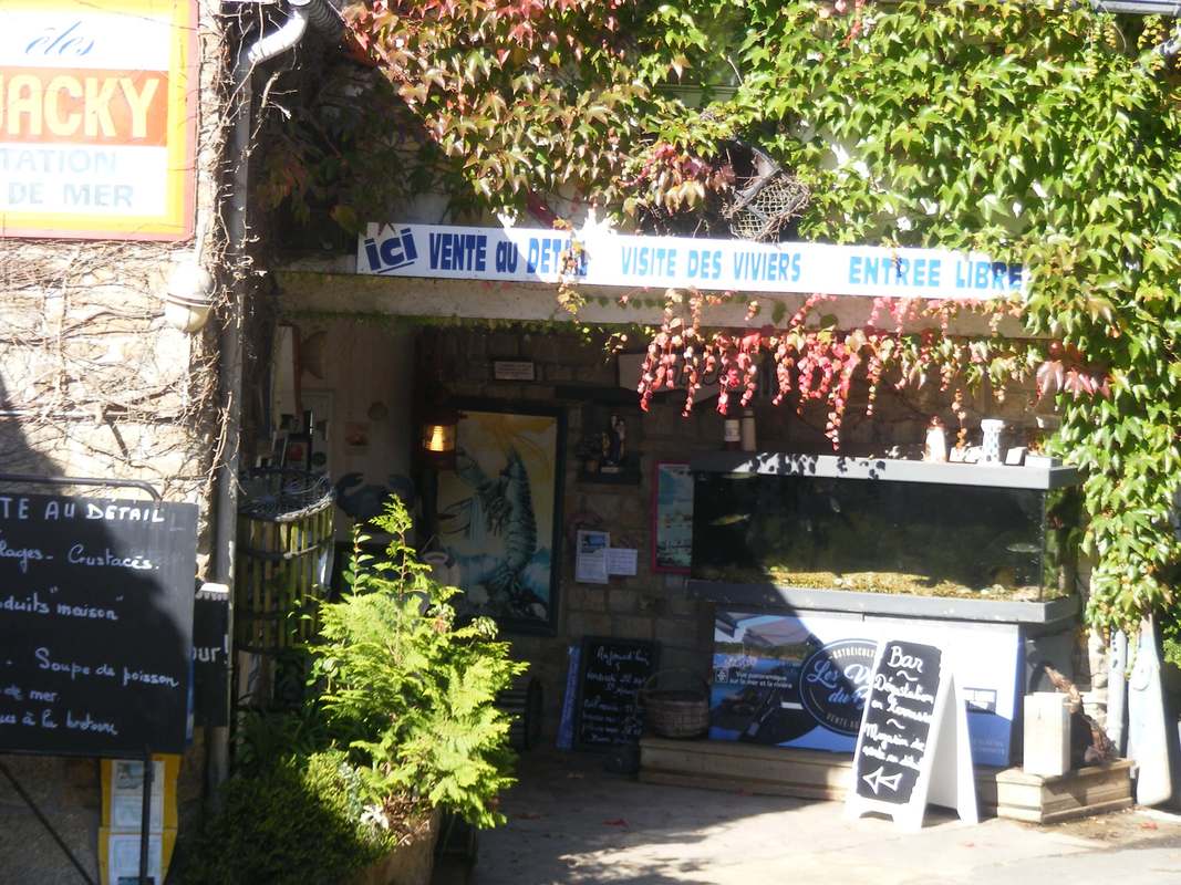
Chez Jacky at Bélon. Excellent for seafood. For an impression of the view, see this page's header picture.
|
Looking back at Port Manec'h from the headland between the 2 rias, nearly 13 miles walking away.
|
|
The fourth day's walk (12.4 miles) is around the next ria, the Bélon finishing at Kerfany les Pins. The second longest day's walk, but again with little elevation.
If two rias is too much for you, the two days can be combined so you walk up to Pont Aven, have lunch then a lift to the top of the second ria; walking to Kerfany in the afternoon. 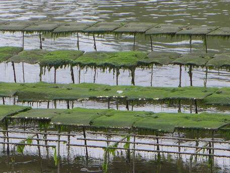
Oyster beds on the Belon ria.
(Photo courtesy of Sandi, walked S Finistère June 2019)
|
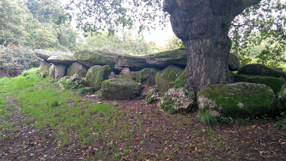
Allée couverte, just off the GR34 heading for Kerfany.

Le Bélon
|
|
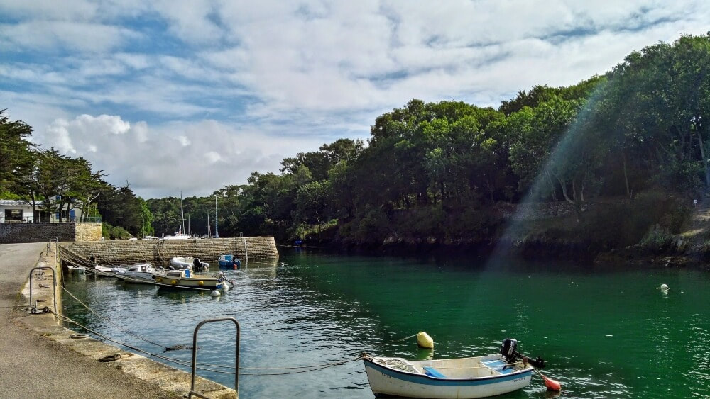
The fifth day's walk (9.1 miles) takes you past the campsite at île Percée where you will be spending the night. We'll pick you up from Port de Merrien on the quay in the photo below or wherever suits. The port de Brigneau en route is exceptional as is the protected forest around Merrien.

Port de Merrien. Coquillage can be purchased from the white building.
|
Brigneau
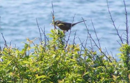
Dartford Warbler seen near Merrien
|
|
The sixth day's walk is to Le Pouldu at the mouth of the Laïta, the border with Morbihan. Le Pouldu is a modest, pleasant resort with superb beaches and swimming. Doëlan, en route, is a pretty port, popular with those who seek to lunch in the most pleasant of surroundings.
Paul Gauguin spent time at Le Pouldu (as well as Pont Aven). He made many paintings of local scenes, put into context by small, but robust reproductions in situ on a "Gauguin trail". There is also a museum in the old café frequented by the artist and his friends featuring original murals they made - perhaps in lieu of payment of a bill. The museum is sometimes even open. |

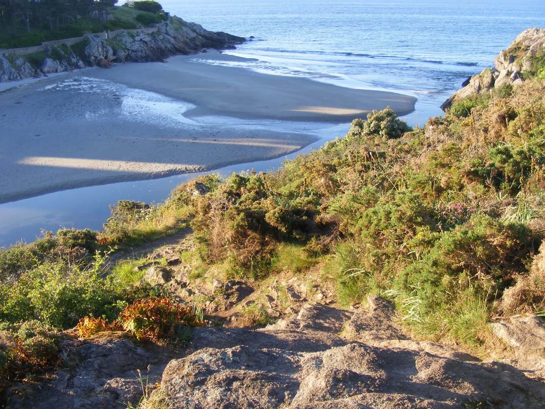
Roche Percée between Pouldu & Doëlan. Almost impossible to find by car; unmissable on the coast path.
|

|

|

|